Cork City Council Launches Innovative Digital Tool for City Wide Neighbourhoods
29/08/2025
Cork City Council has today launched a new and innovative digital tool aimed at neighbourhoods, communities, planners, consultants and developers.
The Neighbourhood Profiles Digital Hub is an interactive version of the 2025 Neighbourhood Profile Report, a report based on 2022 census data, where social-demographics, employment, housing and commuting patterns, for example, can be analysed at a neighbourhood level. The insight available through the ‘Digital Hub’ will enable citywide communities to have greater involvement in the strategic development of their neighbourhoods.

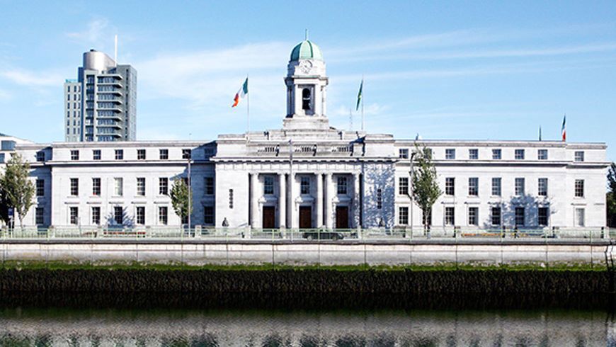
At a launch event in City Hall hosted by the Lord Mayor, Cllr. Fergal Dennehy, community groups, planners, residents' associations and City Council staff were given an overview of the report and a demonstration of the accompanying Digital Hub which is now live and available online. The significance of the Neighbourhoods for strategic planning was highlighted by the presentation from the Cork City Council Strategic Planning & Heritage team, who worked in tandem with the City Council Community team to create this report and deliver the digital tool. The researchers from AIRO, the All-Island Research Observatory, travelled from Maynooth University to demo the digital dashboards that they developed.
The 2025 Cork City Neighbourhood Profiles Report builds on the first, launched in 2021, providing up-to date profile of 44 city-wide neighbourhoods. The report and tool interpret the available data, recognising patterns to allow informed decision making and planning. The ‘Digital Hub’ has been developed to gather data in a user-friendly and engaging manner, to empower community groups, academics and all Cork residents to access rich data available for their area and to have the tools to engage in neighbourhood planning and community development.
Valerie O’Sullivan, Chief Executive of Cork City Council said, “Putting our communities at the centre of our decision-making is really important for our city. We are proud to be leading in Neighbourhood planning and seeing other cities adopting this approach. Cork City has a rich network of neighbourhoods where people can access the local services they need within their own area. The strategic planning and community teams have been actively working together on this project and are now bringing the profiles to a more accessible version with this new digital hub.”
Director Planning and Integrated Development at Cork City Council, Niall Ó Donnabháin emphasised the importance of the new tool in future planning, saying, “Neighbourhoods are the building blocks of our city, continuously changing and influencing how our city looks, feels and works. We have been growing our team and our ambition around data-driven strategic planning. This new iteration of the Cork City Neighbourhood Profiles was a great opportunity to create a digital hub that highlights the digital and analytical tools that are used for decision-making and make them available to all decision-makers in and outside the City Council, in health, education, transport. It is a public tool that everyone can use. “
“The new digital hub will be a great tool to have a level of comparative data for neighbourhoods. In the past, we have used Pobal & CSO data, but the updated profiles provided a multi layered data at a local level. So, it will be very beneficial to add this data to grant applications for Social Inclusion and Community Activation Programme grants and programmes, Climate action grants and Local Enhancement Programmes going forward” said, Roy Watson, General Manager, The Glen Resource Centre.

The Cork City Development Plan 2022-2028 focuses on fostering liveable neighbourhoods. The plan looked beyond the Census areas to understand the network of historic and emerging neighbourhoods that offer a diverse range of housing, transport, health care, education, shops and community and cultural infrastructure, based on 10-minute walking areas (800m).
To help understand the character and needs of each neighbourhood, Cork City's Strategic Planning and Community teams have worked with the All-Island Research Observatory (AIRO) to provide insights at neighbourhood level by compiling census data on socio-demographics, employment, housing and commuting patterns.
Cork City Council is planning an online tutorial for community groups in the Autumn.
The Neighbourhood Report is based on CSO data. The report was prepared by AIRO in cooperation with Cork City Council's Strategic Planning & Heritage and Community Teams.
ENDS
Explore the Digital Hub at the following link:
https://experience.arcgis.com/experience/a1a514971ced4c2292305956dcccdfcb/page/Home
The 2025 Neighbourhood Profiles report can be found at the following link:
https://publications.corkcity.ie/view/458292446/34/
The data that underpins the report and hub is captured from the following sources:
- 2022 Census (Source: CSO),
- 2022 Census POWSCAR Results (Source: CSO),
- 2016 Census (comparative figures) (Source: CSO),
- Pobal HP Deprivation Index (2022) (Source: Pobal)
If you have questions, contact: planningpolicy@corkcity.ie
For more information on the walkable Neighbourhoods, please see Chapter 2, ‘Core Strategy’ of the Cork City Development Plan 2022-2028. (Volume 1 - Written Statement , CCDP 2022-2028)


