Ballyvolane Strategic Transport Corridor
Planning/Design Phase
Works Extent
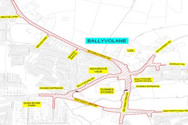
This project entails improving and upgrading Ballyhooly Road from North Ring Road junction to Fox & Hounds junction and onwards to Mervue Lawn and also along Ballyvolane Road from North Ring Road to Banduff Road. This new infrastructure, when completed, will form part of a sustainable transport corridor between Ballyvolane and Cork City centre.
Objectives
- There is a requirement for major upgrades to the local road network and in particular the need for cycle, pedestrian and public transport infrastructure upgrades to cope with existing and future demand for more sustainable modes of transport.
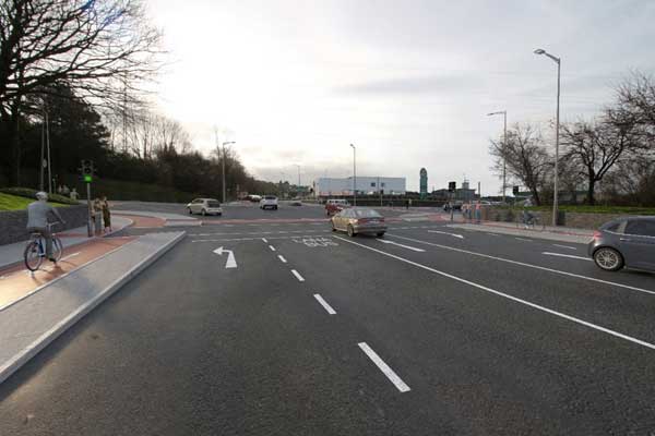
- Enhanced facilities for all road users but with particular benefits for pedestrians, cyclists and public transport users while providing, in as much as possible, for the efficient movement of vehicular traffic within the study area;
- Identifying main areas of delay for bus journeys and expanding the existing bus lane infrastructure and the addition of bus priority control measures to improve current bus journey times and reliability;
- Providing cycle facilities in accordance with the network identified in CMATS, designed in accordance with the National Cycle Manual, delivering a Quality of Service of Level A or better for a primary cycle route and a Quality of Service of Level B or better for a secondary cycle route;
- Providing improved pedestrian facilities along the corridor and providing additional permeability where appropriate to address pedestrian and vulnerable road user desire lines across the project area.
Timeline
Start: Design Phase commenced late 2019.
Finish: Currently awaiting confirmation from An Bord Pleanala for compulsory acquisition of lands (CPO) required to construct the scheme.
For further information please contact Bríd Ní Leidhin, Senior Executive Engineer at email brid_nileidhin@corkcity.ie


